
Invasive Plant Species - Lake Erie Wetlands
Wetlands & Aquatic Invasive Plants

Phragmites, or common reed, is a tall, invasive perennial grass found in wetlands that spreads aggressively through seeds and underground roots, or rhizomes. It forms dense stands that displace native plants, reduce biodiversity, and alter wetland ecosystems by choking waterways and decreasing flood retention. Its scientific name is Phragmites australis, though a native subspecies exists. Description and habitat Habitat: Found in a wide range of wet areas, including marshes, ditches, stream banks, and lake edges. Origin: The invasive P. australis subspecies is native to Europe and Asia and was introduced to North America, likely through ship ballast, in the 19th century. Appearance: A tall, coarse grass that can reach 6 to 15 feet high, with feathery plumes that appear in summer and die back to form standing, dead stems through the winter. The invasive non-native subspecies is typically dark green with a rough stem texture, while the native is lighter green with a smooth stem. Reproduction and spread Seeds: Seeds are produced by late summer and spread by wind and water. Rhizomes: It spreads rapidly through a dense network of underground stems called rhizomes, which can extend many feet horizontally and several feet deep in a single season. Impact: This extensive root system allows it to regrow quickly, making it difficult to control. It also forms a complete monoculture, crowding out native vegetation. Ecological impact Displaces native species: It outcompetes and displaces native wetland plants, which reduces the diversity of plant and wildlife species. Alters ecosystems: Dense stands can choke waterways, reduce water flow, trap sediments, and decrease a wetland's flood retention capabilities. Wildlife value: It offers little value as a food source for many animals compared to native plants, though some animals may use it for cover or nesting. Control Mechanical methods: Cutting can be effective when done repeatedly, particularly when combined with other methods, but is labor-intensive. It is most effective when the cut material is removed from the site. Herbicide application: Foliar-applied herbicides are often the most effective control, especially when combined with mechanical methods. The herbicides should be applied during the active growing season.

Flowering Rush, is an invasive aquatic perennial known for its showy pink flowers and sedge-like appearance, which established along Lake Erie, and Ashtabula counties. It forms a dense, non-native monocultures that crowd out native species, reduce fish habitat, and hinder recreation. Key Characteristics, & Risks in Ohio •Appearance: Produces pink flowers in umbels on round stems up to 3.2 ft tall. In deep water, it grows in a submerged form with limp, long leaves. •Invasiveness: It spreads through thick, rhizomatous roots (rhizomes) and small bulbils, which can break off and spread, making it difficult to control. •Impacts: It alters ecosystems, promotes sediment deposition, and degrades wetlands and shorelines. •Location: Primarily found along Lake Erie, in wetlands, and along rivers and slow-moving streams. Identification and Reporting •Flowers: Pink, with three petals and three sepals, blooming July through September. •Leaves: Narrow, sword-shaped, with smooth edges and a slight triangular twist, growing up to 3 ft tall or 10 ft if submerged. •Reporting: The Ohio Sea Grant and local officials suggest reporting sightings, especially along Lake Erie, to monitor its spread. Management and Control •Hand Digging: Small populations can be manually removed, but extreme caution is required to remove all fragments to prevent further spread. •Cutting: In water, cutting the plant below the water surface can limit its growth. •Avoid Spreading: Clean boats and fishing equipment thoroughly. Do not move the plant to new areas, as it is often transported via mud on boots and equipment. It is important to not confuse this plant with native shoreland vegetation. Its ability to create dense, impassable thickets makes it a priority for control.
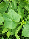
Hydrilla is a highly invasive, non-native aquatic plant spreading in Ohio waterways, including the Ohio waterways, including the Ohio River and Lake Erie basin. It forms dense mats that destroy native ecosystems, bock sunlight, and obstruct boating and fishing. Early detection and control efforts is KEY. Top Troublesome Invasive Plants (2026): •Non-native Phragmites (Phragmites australis): The #1 threat, forming dense, 15-foot-tall stands, driving out native plants, and altering water availability. •Flowering Rush (Butomus umbellatus): Highly invasive in coastal wetlands, replacing native vegetation in marshes. •Hydrilla (Hydrilla verticillata): An aggressive underwater plant that outcompetes natives and clogs water intake pipes. Key Facts on Hydrilla in Ohio •Threat Level: It is considered one of the most invasive aquatic plants, growing up to an inch per day and capable of dominating waterbodies within three years. •Locations: Detected in the Ohio River basin, Lake Erie basin, and specific areas such as Mosquito Lake and Pymatuning Lake. •Impact: It severely disrupts ecosystems, reduces sport fish size, and clogs water intake pipes. •Spread: Primarily spreads through fragments attached to boats, trailers, and fishing gear. •Management: The U.S. Army Corps of Engineers and Ohio Department of Natural Resources use herbicides to control infestations, particularly in late summer, according to the Great Lakes and Ohio River Division.
Purple loosestrife is a highly invasive perennial in Ohio that degrades wetlands, stream banks, and ditches by forming dense, monotypic stands. It outcompetes native plants and spreads rapidly via millions of seeds per plant, reducing wildlife habitat quality. It is considered a noxious weed in Ohio. Key Characteristics & Impact •Appearance: Tall (4–8 ft) stalks with magenta flower spikes blooming from July to September. •Habit: Thrives in wet, sunny areas, often forming dense, impenetrable stands. •Spread: Produces up to 2.5 million seeds annually; also spreads through rhizomes. •Impact: Reduces biodiversity, restricts boat access, and hurts wildlife that rely on native wetland plants. Management and Control •Small Infestations: Hand-pulling is effective, but the entire root system must be removed. •Chemical Control: Spot treatment with aquatic-approved herbicides (e.g., Rodeo, Aqua Neat) is effective in late summer before plant dormancy. •Biological Control: The release of specialized Galerucella beetles has been used to manage large populations. •Mowing: Generally not recommended, as it can spread seeds and encourage growth.

Eurasian Watermilfoil is a highly invasive, submersed aquatic plant found through Ohio that forms dense, thick mats in lake and slow moving streams. It spreads quickly, often clogging waterways, blocking sunlight, and disrupting native vegetation. It is distinguished by having 12-21 leaflet pairs per leaf. Impact and Identification •Identification: Features feather-like leaves arranged in whorls of four around the stem, with over 12 leaflet pairs (unlike native milfoil's 5-10). •Impact: Reduces biodiversity by displacing native plants, creates poor fish habitat, and severely hinders recreation like swimming and boating. •Ohio Presence: It was detected early in the Great Lakes Basin, with early collections recorded at Put-In-Bay on Lake Erie in 1949. Management and Control •Management: Management includes chemical herbicide treatments, which have been used effectively in areas like Indian Lake, though it requires ongoing monitoring. •Biological Control: Researchers are exploring the use of native milfoil weevils, which bore into the stems, to control infestations. •Prevention: To prevent spread, boaters should wash boats and trailers and remove all plant fragments from gear after leaving water bodies. 4 Key Look-alikes It is often confused with native Northern Watermilfoil, which has 10 or fewer leaflet pairs. Another, Coontail, is also a look-alike but has stiffer, forked leaves rather than the "feather" look of milfoil.

European frog-bit is an aquatic invasive plant in Ohio forming dense, floating mats that destroy wetlands, reduce oxygen, and threaten native species. It resembles miniature water lilies with heat-shaped leaves and white, 3-petaled flowers, rapidly spreading along Lake Erie and Inland. Key Details on Ohio Infestations Location: Primarily found in Lake Erie coastal wetlands and surrounding areas, including sites near Oak Harbor and the Old Woman Creek Estuary. Impact: The mats restrict sunlight and water movement, which kills native plants, affects fish habitats, and hinders boating/fishing. Spread: It spreads rapidly via dangling roots and turions (dormant buds) that survive winter and rise in spring. Management: Ohio Department of Natural Resources (ODNR) and partners, such as the Surfrider Foundation, conduct in-water, manual removal in high-priority areas. How to Identify Leaves: Kidney-shaped to heart-shaped leaves, 1.2–6 cm wide, with purple-red undersides. Flowers: Small white flowers with three petals and a yellow center, appearing June–September. Roots: Dark, tangled roots hanging from the plant that do not always touch the bottom.

Narrow-leaved cattail and hybrid cattail are invasive, non-native perennial plants in Ohio that displace native vegetation, reducing biodiversity in wetlands. They possess narrow leaves and distinct gaps between brown flower spikes, with hybrids growing taller and ore aggressively than natives in shallow to deep water. Identification in Ohio •Narrow-leaved Cattail (T. angustifolia): Introduced to Ohio, these have narrow leaves (1/4 to 3/4 inch wide), light green, stiff stalks up to 10 ft tall, and a 1–4 inch gap between the brown female flowers and upper male flowers. •Hybrid Cattail (T. x glauca): A cross between T. angustifolia and native T. latifolia. It often exhibits "hybrid vigor," growing taller and denser than either parent, and has a smaller gap between flower parts. •Distinction: Native broad-leaved cattail (T. latifolia) has wider leaves (1/2 to 1 inch) and no gap between the male and female flowers. Invasive Behavior in Ohio •Ecological Impact: They aggressively spread via rhizomes, forming dense monocultures that crowd out native plants, reduce plant diversity, and decrease fish habitat quality. •Habitats: These cattails thrive in wetlands, along lake shores, and, due to salt tolerance, are common in highway drainage ditches, allowing them to invade new areas. •Management: Control methods include digging up rhizomes, cutting stalks below water level, and using herbicide applications, which are most effective June through July.